Berlin · Then & Now
The Brandenburg Gate: Berlin Then & Now
For 28 years the Brandenburg Gate stood in no-man's-land — walled off, unreachable, the emptiest place in a divided city. But it had carried Berlin through empire and war long before that. Here is one gate across a century, in real photographs, each pinned to the exact spot it was taken.
The heart of imperial Berlin
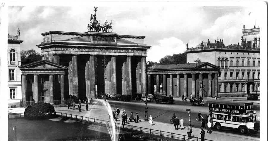
For over a century the Brandenburg Gate was simply the centre of Berlin — the great neoclassical arch at the head of Unter den Linden, the Quadriga and her chariot up on top, a fountain playing on Pariser Platz. This is 1918, the year the German Empire ended: double-decker buses, strollers in hats, the grand square going about its ordinary day.
1945: the city in ruins
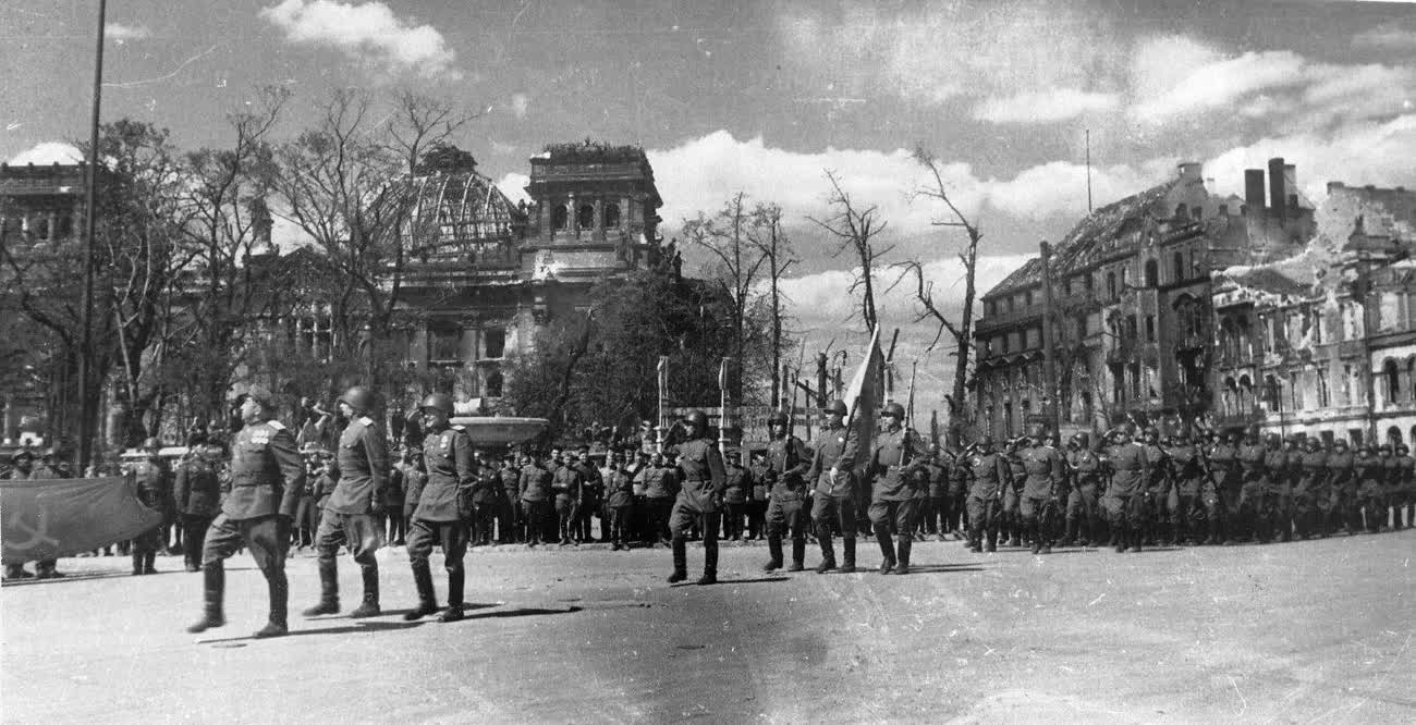
Then came the Third Reich and the war it started. In the spring of 1945 the Battle of Berlin ended here among the rubble — the Reichstag stormed, its dome burned to a skeleton, Soviet troops parading through the wreckage a few hundred metres from the gate. The Quadriga had been shot to pieces; Pariser Platz was a field of broken stone.
The wasteland behind the gate
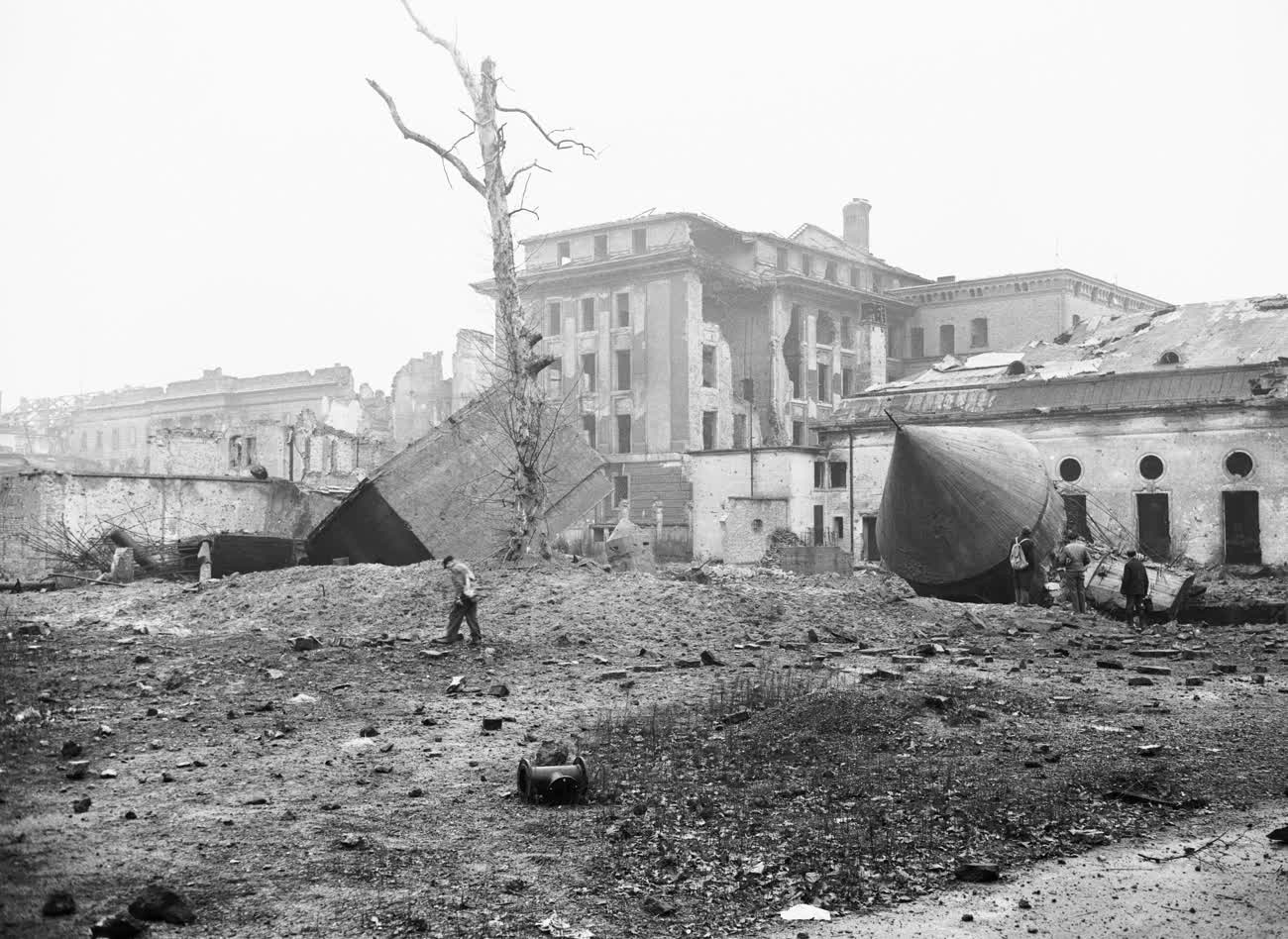
Just south of the arch, where the government quarter had stood, this was all that remained in 1948 — a moonscape of craters and shattered walls around the ruined Reich Chancellery, whose garden had hidden Hitler's bunker. A few figures pick their way across the emptiness. Berlin had lost the war and most of its centre with it.
1961: a line through the city
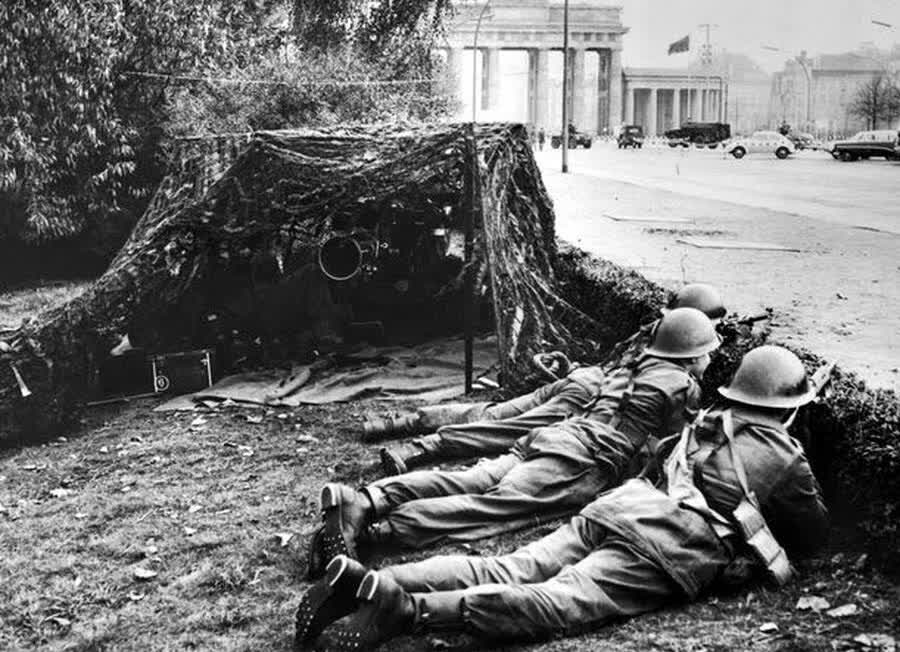
On 13 August 1961 the East began to wall itself in, and the border ran right past the gate. Here Allied soldiers lie in a sandbagged position, a machine gun trained down the empty avenue toward the arch, as the two halves of the world squared off. Overnight, the Brandenburg Gate had become a front line.
Stranded in no-man's-land
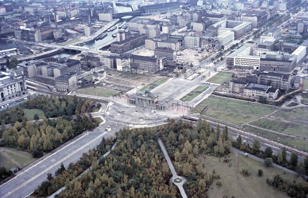
From the air the wound is plain. The Wall and its cleared border strip curve right around the gate, sealing it onto a barren island between East and West. The Tiergarten's trees stop at the line; beyond, Unter den Linden runs east into the GDR. For a generation, no one could walk through.
The emptiest place in Berlin
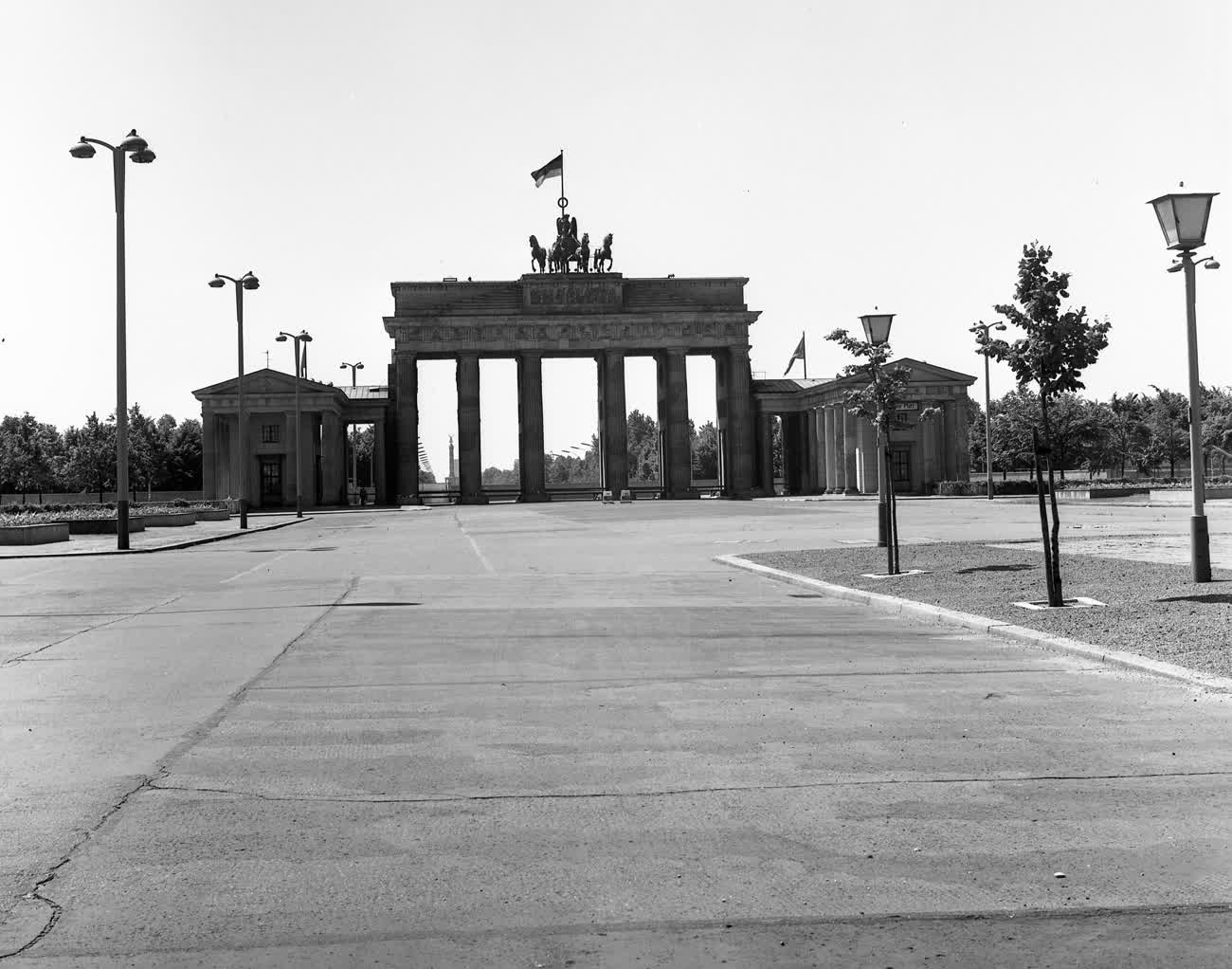
At ground level, the gate stood alone. An East German flag flew from the top; the plaza below was swept and empty, the arches blocked, the border running just in front. This is 1970 — the middle of nearly three decades in which the busiest spot in Berlin was also the stillest.
Twenty years of winter
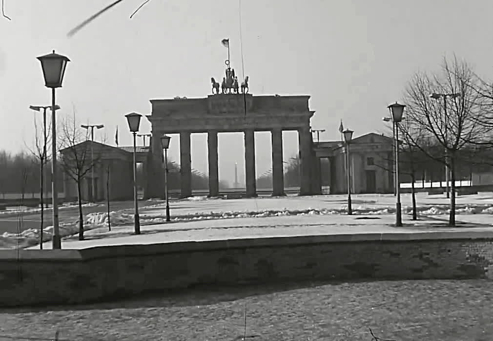
And here it is again in 1981, in the snow — the low curve of the Wall in the foreground, bare trees, not a soul in sight. Ronald Reagan would stand near here in 1987 and say, "tear down this wall." It still seemed impossible. The gate had been unreachable so long that Berliners had stopped expecting to pass through it.
Stand on the same spot
On 9 November 1989 the Wall fell, and a few weeks later the Brandenburg Gate reopened after 28 years. Today you can walk straight through it, across a rebuilt Pariser Platz thronged with people — the arch is now the symbol of a reunited city. The hardest thing about an old photograph is standing where the photographer stood and seeing what they saw. That's what Time Portal is for: every historical photo is pinned to the precise spot it was taken. Stand at the gate, open the map, and drag the year back — watch the Wall rise again, then the ruins, then the fountains of 1918.
Explore Berlin's past on the map.
The rest of Berlin, decade by decade and place by place: about 30,000 old photographs of Berlin.
More then & now stories are on the way. If you like these, see how another skyline changed — the Twin Towers of New York.