
New York · Then & Now
The Twin Towers: New York Then & Now
For nearly thirty years the Twin Towers were the tallest thing on the New York skyline — and then they were gone. But long before them, and all around them, this corner of Lower Manhattan was already a city. Here it is across a century, in real photographs, each pinned to the exact spot it was taken.
Before the towers, a downtown of its own
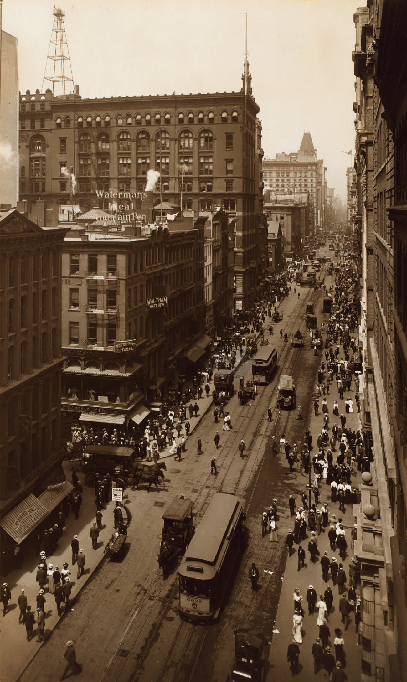
Long before the World Trade Center, the blocks just west of here were dense, low, and busy. This is Broadway at Cortlandt Street in 1907 — straw boaters and streetcars, fountain-pen signs and cigar shops, a downtown already generations old. Cortlandt Street ran west from this corner straight into what would one day be the towers' footprint.
The neighbourhood that stood here
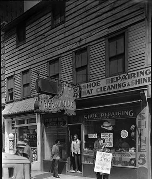
By the 1930s these streets were a working district of small trades — shoe repair, hat cleaning, radio and electronics shops packed window to window. This storefront stood on Vesey Street, along the northern edge of the future site. In the mid-1960s the whole quarter — hundreds of businesses — was cleared to make room for what came next.
The great excavation
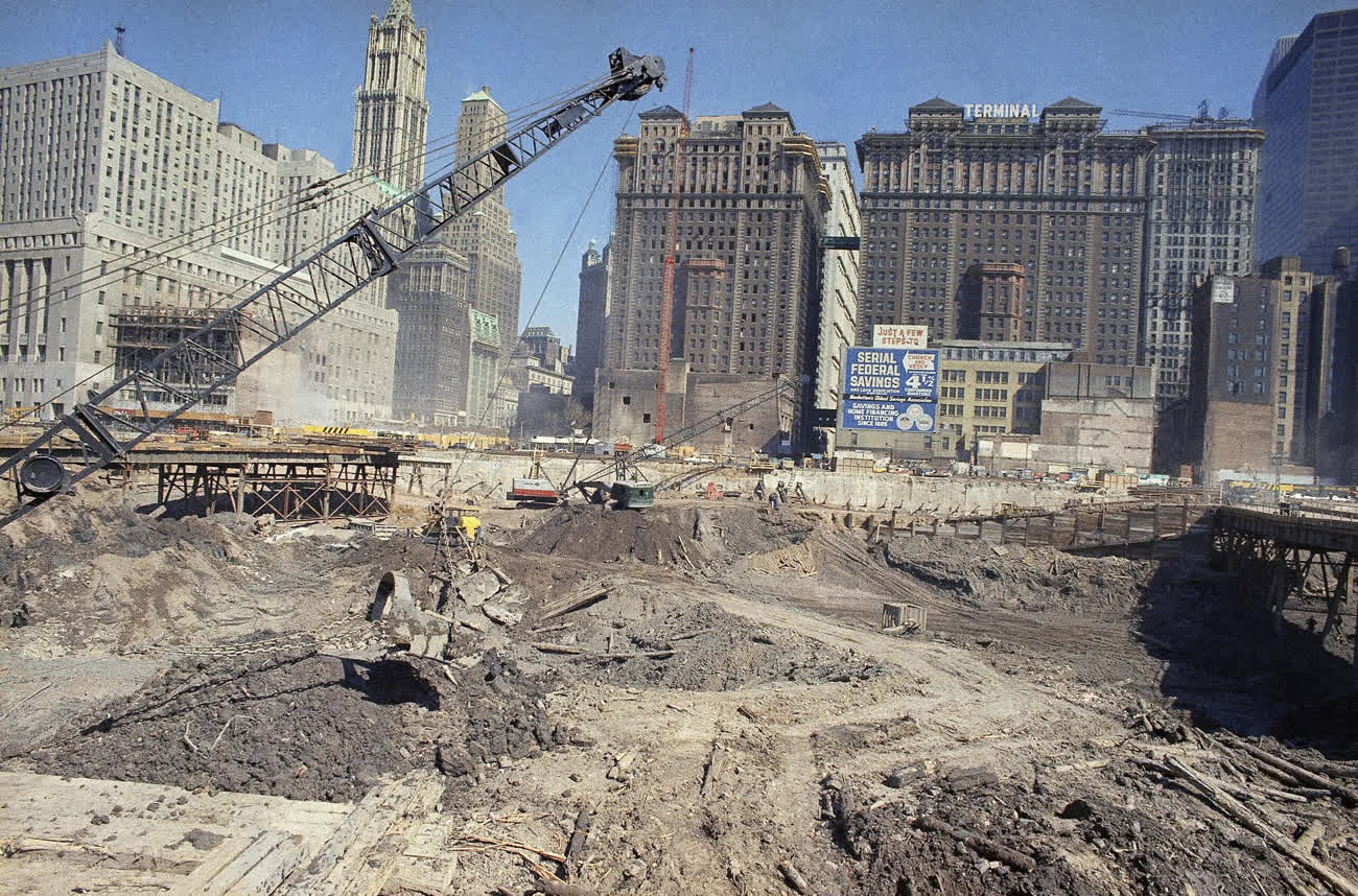
Demolition began in 1966, and the site became one of the largest excavations the city had ever seen. Here in 1968 the pit is dug down toward bedrock, a crawler crane working its edge, the older skyline — the Woolworth Building's green crown, the warehouse blocks behind it — still standing guard. A billboard on the far side points the way to "Church and Vesey."
Steel into the sky
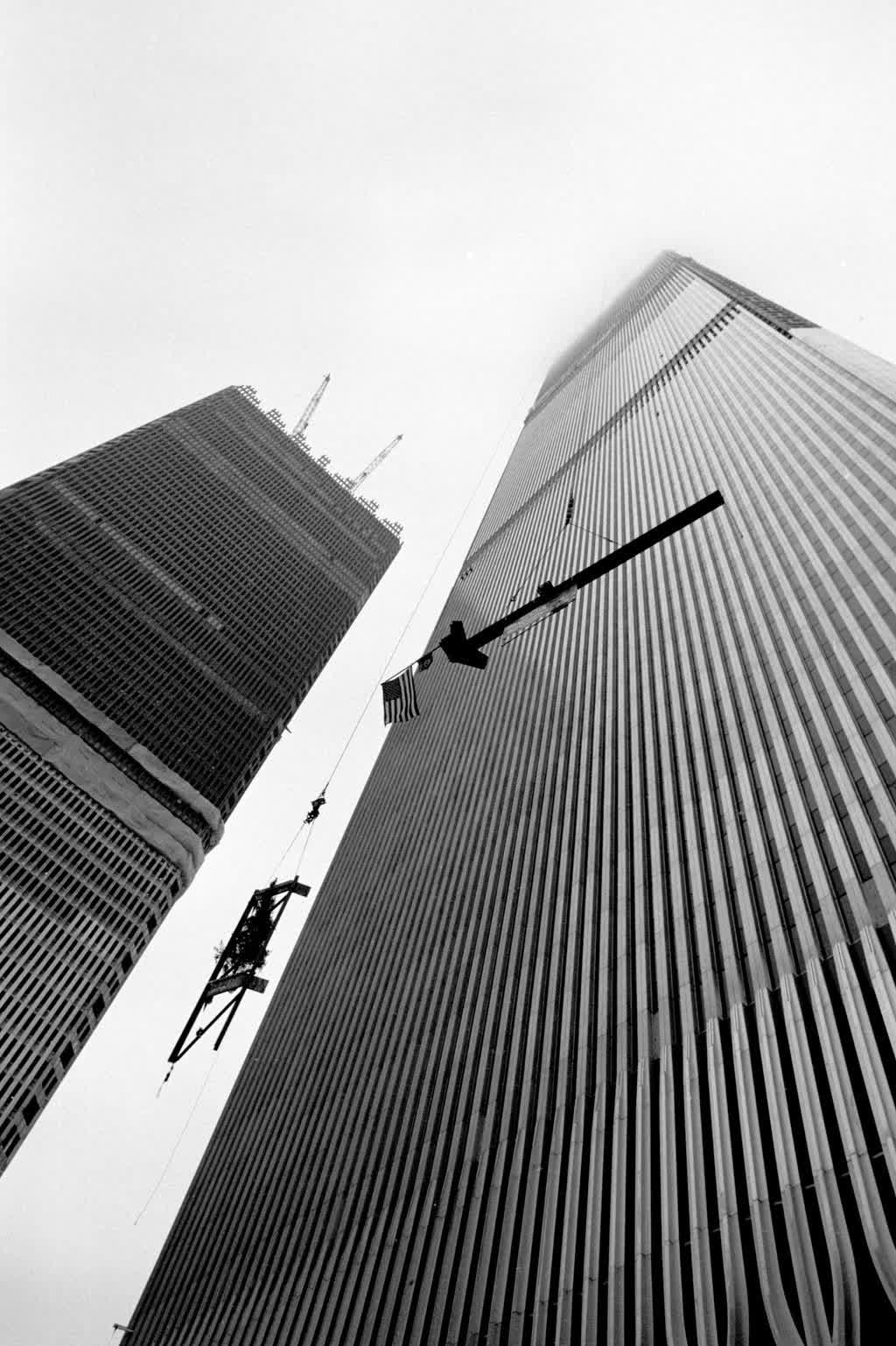
Then they climbed. The towers rose floor by floor on a lattice of steel, each one racing the other upward — a worker and a small American flag out on a beam high above the street. By 1971 both had topped out; when they opened in 1973 they were the tallest buildings in the world.
Two lines against the sky
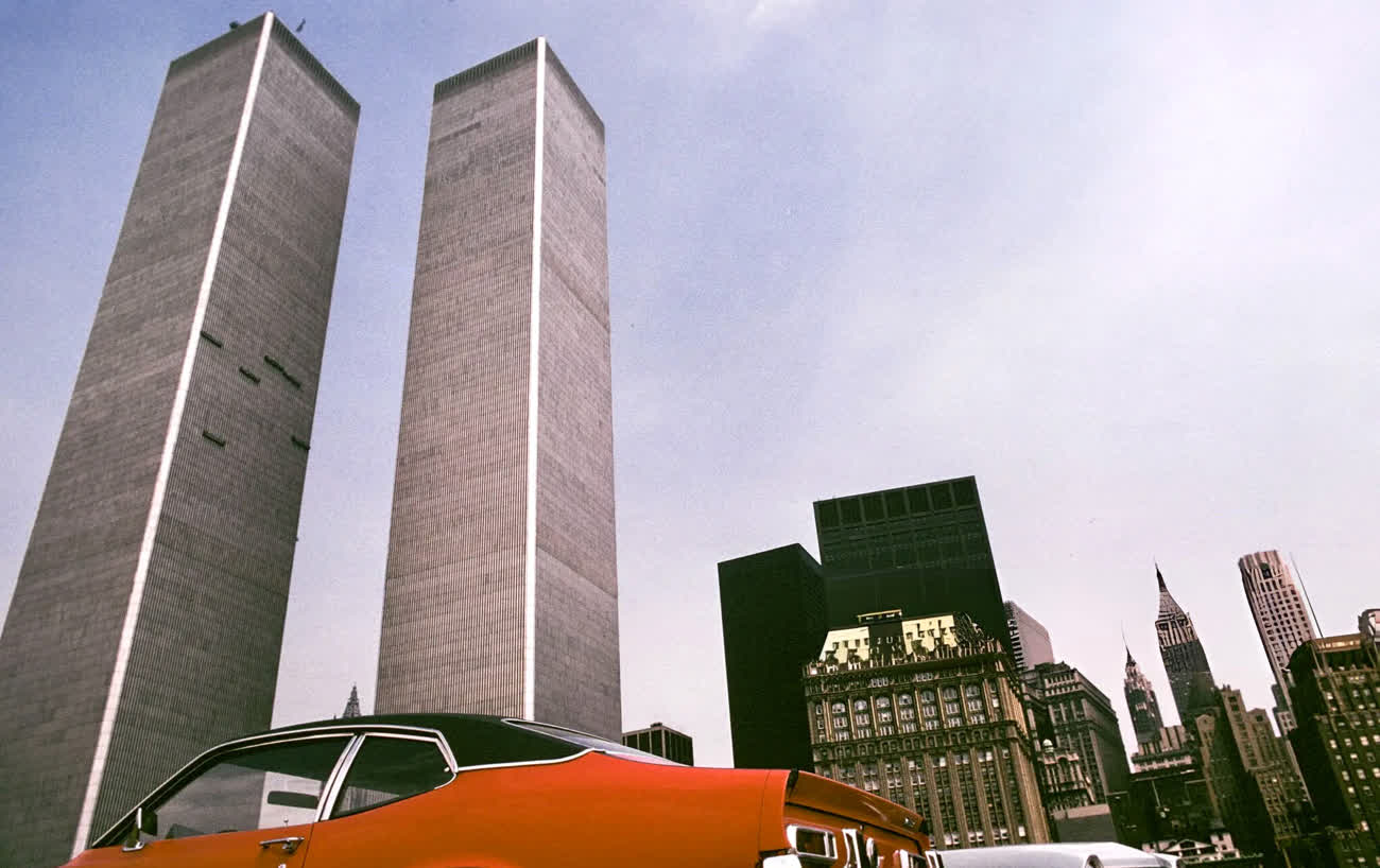
Finished, they were almost impossibly plain: two flat silver-grey shafts, 110 storeys each, standing a quarter of a mile high. Architect Minoru Yamasaki gave them their narrow ribbed sides, which seemed to change colour with the light. Here they are in 1974, brand new, framed by a parked car and the towers of Midtown — the Empire State and Chrysler buildings just visible far uptown.
From above
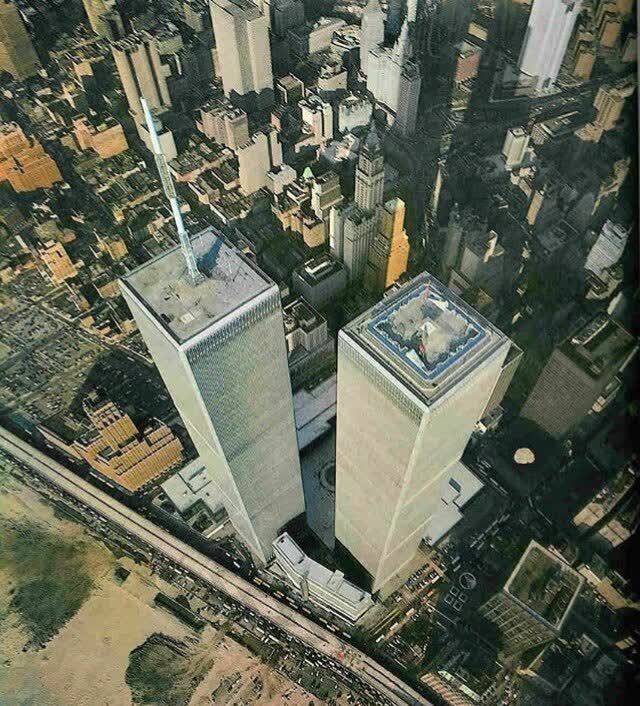
From directly overhead the scale is easier to feel: two great roofs floating over Lower Manhattan, the streets and older skyscrapers shrunk to a model far below. The north roof carried the broadcast mast that beamed television across the region; between the towers lay the plaza that tens of thousands of office workers crossed every day.
Inside
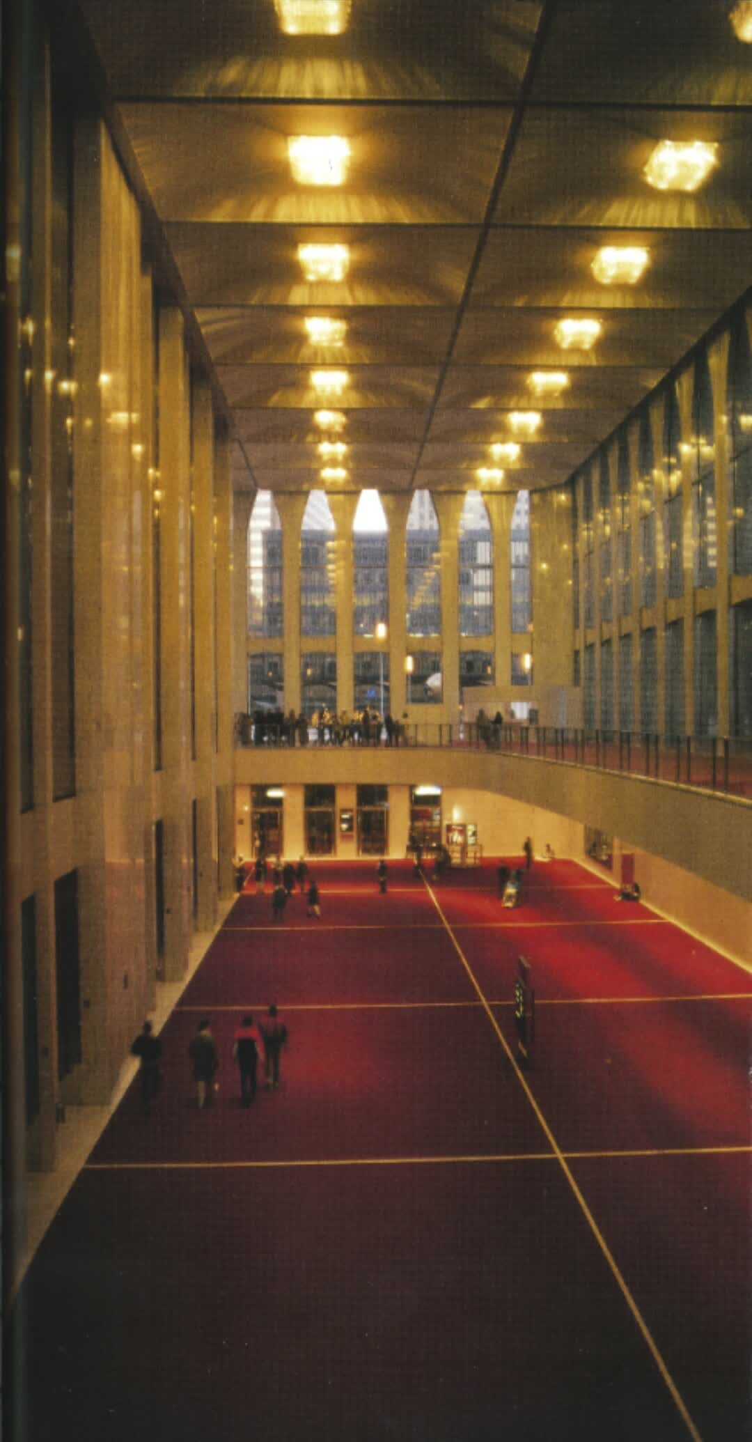
Down at street level they were a small city — concourses, a shopping mall, a subway station, and lobbies like this one in 1988, five storeys of glass and steel with light pouring through the tall gothic arches Yamasaki set at the base of each tower. Above these floors, on an ordinary weekday, tens of thousands of people were at work.
The skyline they made
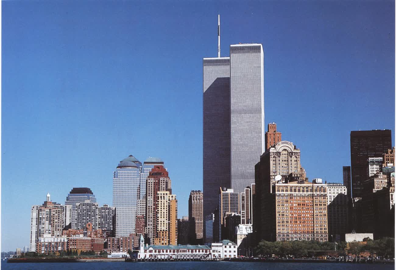
For a generation this was simply how New York looked from the water: two silver towers standing head and shoulders above everything around them, the antenna on the north one catching the last of the light. This is the view in 1995, from the harbour off Battery Park City — the towers in the middle of their long, ordinary life at the centre of the city.
Stand on the same spot
On September 11, 2001, both towers were destroyed in the terrorist attacks, and nearly three thousand people were killed. Today two reflecting pools rest in the exact footprints of the towers, their bronze rims inscribed with the names of the dead. The hardest thing about an old photograph is standing where the photographer stood and seeing what they saw. That is what Time Portal is for: every historical photo is pinned to the precise spot it was taken. Stand at the memorial, open the map, and the Twin Towers rise again over Lower Manhattan — exactly where they were.
Explore New York's past on the map.
The rest of New York, decade by decade and place by place: about 33,000 old photographs of New York.
More New York stories are on the way — the harbour, the old elevated railways, and the city that stood before the skyscrapers.