
Old photos · Ukraine
Old photos of Kyiv
From the first bridge over the Dnieper in 1848 to the Soviet city of the 1980s — including the Khreshchatyk that was blown up in 1941 and built again after the war.
Time Portal's archive holds about 58,000 photographs of Kyiv (Kiev), taken between 1848 and 2000, each pinned to the spot where the photographer stood. 69% of them date from 1955 or later and are free to browse at map.timeportal.app with no account; the older ones open with Pro. The oldest, dated 1848 in the archive, shows the first piers of the Nicholas Chain Bridge going up over the Dnieper that November — titled in the archive as the oldest photograph taken in Kyiv.
- Photographs
- 58,000
- Oldest
- 1848
- Busiest decade
- 1980s
- Free, 1955 on
- 69%
How many photographs, decade by decade
The busiest decades for Kyiv are the 1980s and the 1970s — 11,871 and 11,204 photographs. 1,894 were taken before 1900. Everything from 1955 onward is free to open on the map; the older photographs are part of Pro.
| Decade | Relative size | Photographs |
|---|---|---|
| before 1860 | 51 | |
| 1860s | 98 | |
| 1870s | 272 | |
| 1880s | 312 | |
| 1890s | 1,161 | |
| 1900s | 1,657 | |
| 1910s | 2,302 | |
| 1920s | 1,599 | |
| 1930s | 2,702 | |
| 1940s | 5,116 | |
| 1950s | 6,617 | |
| 1960s | 8,092 | |
| 1970s | 11,204 | |
| 1980s | 11,871 | |
| 1990s | 5,109 |
Where the photographs were taken
Counted in a small square around each place — about 250 metres each way — so a number is every photograph taken there, of the place itself or of the street beside it. Each place opens the map on that spot.
| Place | Photos | Oldest |
|---|---|---|
| Khreshchatyk and Maidan | 5,310 | 1858–1860 |
| St Sophia's Cathedral | 1,971 | 1871 |
| Andriyivskyy Descent | 1,561 | 1858–1860 |
| The Kyiv Pechersk Lavra | 2,836 | 1858–1860 |
| Kontraktova Square, Podil | 555 | 1876–1879 |
| The Golden Gate | 620 | 1867 |
What changed
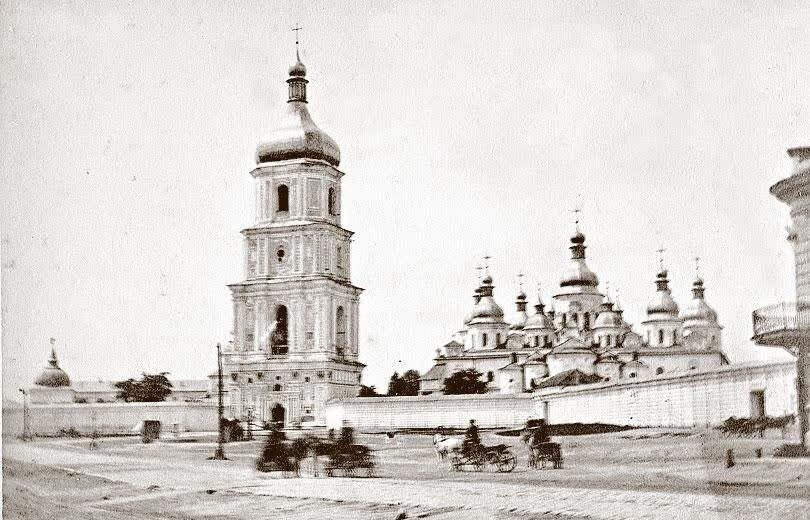
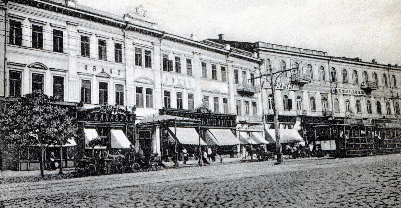
The archive's Kyiv opens on a building site: the piers of the Nicholas Chain Bridge going up across the Dnieper in November 1848. Most of what follows is the city centre, and what it shows most sharply is Khreshchatyk. In September 1941, days after German troops entered the city, explosives left behind by the retreating Soviet side destroyed most of the street. It was rebuilt from the ground up after the war, as the boulevard that stands today.
The monasteries lost buildings too. St Michael's Golden-Domed Monastery was demolished in the 1930s and rebuilt in the late 1990s; the Dormition Cathedral of the Lavra, blown up in November 1941, was rebuilt by 2000.
Questions about old photos of Kyiv
Where can I see old photos of Kyiv on a map?
On Time Portal: about 58,000 photographs of Kyiv, each pinned where it was taken, most with the direction the camera faced. The map is free in any browser at map.timeportal.app — photographs from 1955 on need no account — and there is an app for iPhone and iPad.
What is the oldest photograph of Kyiv in the archive?
The oldest precisely dated photograph, from 1848, shows the first piers of the Nicholas Chain Bridge going up over the Dnieper that November — titled in the archive as the oldest photograph taken in Kyiv. 1,894 of the Kyiv photographs were taken before 1900.
Which years of Kyiv are best covered?
The 1980s, with 11,871 photographs, and the 1970s, with 11,204. 69% of the Kyiv photographs date from 1955 or later.
Open Kyiv on the map
Other cities: Moscow, Saint Petersburg, New York, Berlin, Paris, Prague, Tbilisi, Odesa, Riga, Rome, London. Or search any address on the map, or in the app.
The counts on this page are free to reuse under CC BY 4.0 — credit Time Portal and link here. The photographs are not ours to license: they belong to their photographers and the archives that keep them.